


Whether it is mapping, thermal imaging, or general inspections, we’ve got you covered!
At Fratoni Drone Solutions, our goal is to streamline your mapping and inspection tasks to save you valuable time and resources. Our cutting-edge drone technology empowers us to efficiently gather accurate data, providing you with comprehensive insights for better decision-making. By leveraging our services, you can optimize your operations, saving you time and money. Partner with Fratoni Drone Solutions today to experience the difference firsthand.
Our Equipment

The Matrice 350 RTK

The M350 RTK is the top of the line enterprise drone. This workhorse gives us access to cutting-edge technology, including LiDAR, thermal, and zoom cameras, along with a repertoire of other products fit to exceed in any scenario.
The Zenmuse H30T
The DJI Zenmuse H30T is the latest and greatest Matrice 350 payload. It is equipped with a 24 mm-wide camera, up to a 34x optical zoom and 400x digital zoom camera, a 1280x1024 thermal camera, a 3,000m laser range finder, and more. This versatile payload has a range of tools to assist in any situation.
At Fratoni Drone Solutions, we are constantly updating our equipment to meet the demands of the ever-evolving industry. We are also committed to meeting our clients needs even if that means purchasing or renting equipment we don’t already have.

Mapping
-
Leverage our cutting-edge LiDAR technology to capture precise and detailed terrain data, even through dense vegetation and tree canopies. This advanced solution provides unparalleled accuracy for your mapping, surveying, and land management needs, ensuring comprehensive insights and informed decision-making.
-
Enhance your projects with our state-of-the-art 2D and 3D mapping solutions, delivering highly accurate and detailed representations of any area. Whether for urban planning, construction, or environmental monitoring, our advanced mapping technology ensures you have the comprehensive data you need for optimal results.
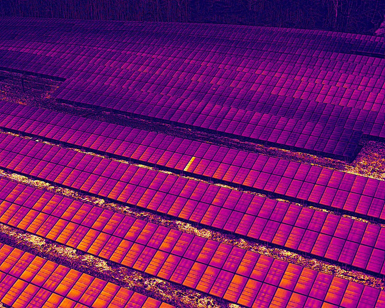
Thermal Imaging
-
Harness the power of our drone thermal imaging services to detect heat anomalies and inefficiencies across various applications. Ideal for situations such as solar farms, building, and equipment inspections, our advanced technology ensures you can quickly identify and address issues, enhancing performance and efficiency no matter the industry.
-
Our drone thermal imaging services are invaluable for search and rescue operations, providing the ability to detect heat signatures and locate missing persons quickly and efficiently. This advanced technology is also highly effective for animal recovery searches, ensuring swift and accurate results in critical situations.

Visual Imaging
-
Drone visual inspections offer significant benefits to customers by providing a safe, efficient, and detailed means of assessing inaccessible or hazardous areas. With high-resolution imagery and real-time data capture, businesses can quickly identify potential structural issues or maintenance needs without the costs and risks associated with traditional inspection methods. This data not only enhances operational efficiency but also allows for timely decision-making, ultimately leading to cost savings and improved asset management.
-
Line of sight drone services enhance construction planning by offering a unique perspective on proposed projects. By capturing aerial views from various altitudes, our drones allow clients to visualize how the views from structures will appear within their surroundings. This capability helps stakeholders make informed decisions about site layout, design aesthetics, and environmental impact, ultimately streamlining the planning process and ensuring alignment with project goals.

Contact us.
ben.fratonidronesolutions.com
(207) 400-6969